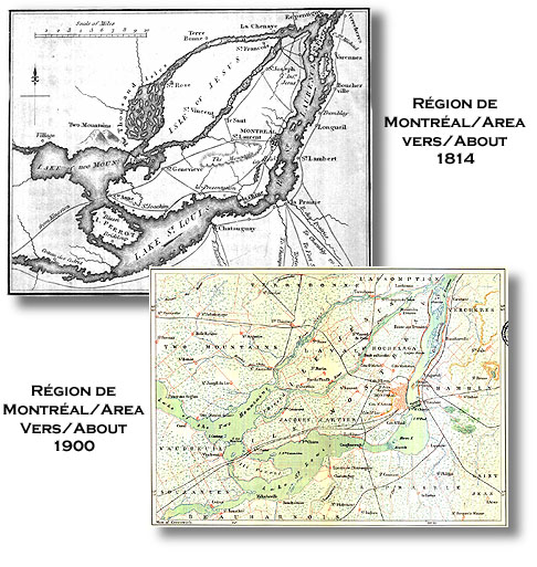
There are several interesting points of comparison between the two maps above which show a
marked increase in cartographic knowledge of the Island of Montreal. For example, compare the configuration of the River Jesus (rivière Jésus)
which links the Lake of Two Mountains (lac des Deux-Montagnes) and the St-Lawrence to the north of Jesus Island (Ile Jésus).
Similarly, compare the shape of Perrot Island (Ile Perrot), located at the western end of Lake St-Louis,
the shape of the Lake of Two Mountains (lac des Deux-Montagnes) and the configuration of the north shore of Lake St-Louis.
The 1900 map allows us to easily find the main communities on the Island of Montreal and in so doing
better understand the geographic context of the spread of the Pilons on the Island. The first
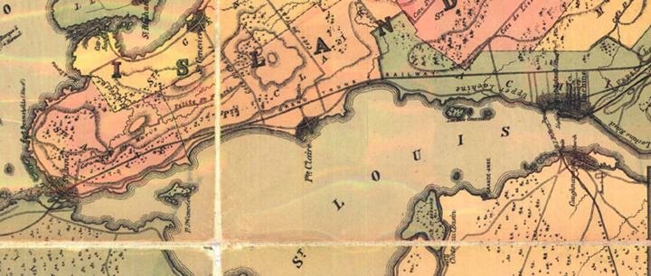
point to note is that the early generations of Pilons settled mostly, along the edges of Lake
St-Louis, on the south side of the island. This is no surprise since we know that the canoe brigades
which left for the Upper Country (les pays d'en haut) assembled on this body of water before beginning the
first leg of the trip just above the Lachine Rapids. The communities of Pointe-Claire, Ste-Anne-du-bout-de-l'le
and Lachine (seen on the inset below) were thus well located to facilitate the departures and arrivals of the voyageurs.
|